|
|
|
|
|
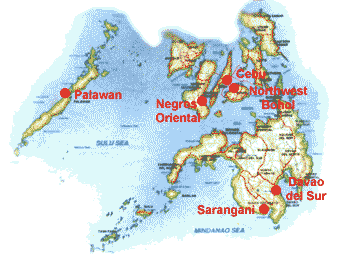
Palawan CRMPs work in Palawan focuses on San Vicente, 180 km from Puerto Princesa. Known to the outside world primarily for its 14-km White Beach, San Vicente is, to CRMP, a rich ground for instituting programs in coastal resource management. This municipality northwest of Puerto Princesa City has four out of the 165 fishing grounds found in Palawan: Imuruan Bay, Caruray, Pagdanan and Jibbon Bay. With forest reserve areas covering 86.8% or 68,834 hectares of the total land area of nearly 80,000 hectares and a coastline extending to 120 kms, majority of San Vicentes 20,000 residents depend on fishing for livelihood. First Out The maps were produced through a participatory coastal resource assessment (PCRA) conducted recently by CRMP in the area. They are currently being validated and used to initiate coastal resource management planning in the barangays. PCRA, which involves extensive participation of local coastal resource users in data gathering, represents the first major phase in the planning and implementation of coastal resource management. Lead the Way,
Port Barton A popular beach hangout, Port Barton has a small-scale tourism industry which thrives under the communitys strong commitment to planned and integrated management of coastal resources. CRMP hopes to turn the area into a model for coastal resource management and a springboard for more focused coastal management planning in other barangays. Outputs from CRMPs work in Port Barton will serve as inputs to the San Vicente Municipal Coastal Resource Management Plan. To build enthusiasm for the San Vicente plan and expose local leaders to successful resource management experiences in other coastal areas, CRMP organized last September 1997 a study tour of Cebu, Bohol and Negros Oriental. Twenty-five local officials and community leaders from San Vicente joined the tour. A 10-day integrated coastal management training is scheduled this month. § |
|
| Palawan
| Negros | Northwest
Bohol | Cebu | Sarangani
| Davao del Sur |
|