|
|
|
|
|
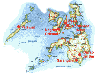
The learning area covers three municipalities (Alabel, Malapatan and Glan) along the 125-km coastline of Sarangani Bay, the municipalities of Maasim, Maitum and Kiamba, and one chartered city (General Santos City), or a total of 267 km of coastline, 67 barangays and a population of nearly 200,000 persons (1995). Coastal management problems identified here are typical of fast developing coastal areas. Most land areas have been converted to agriculture and fishponds, and very little of the coastal land retains natural vegetation. As a result, the Bay suffers from sedimentation. High fishing pressure has also been noted, and there are reports of the use of toxic substances and fine mesh nets, as well as the catching of juvenile fishes in some areas. CRMP enjoys strong local government support, which could very well spell the difference between sustainable development and further degradation of coastal resources in the area. Moving Ahead In September, a seminar on community organizing was conducted for 166 community organizer-volunteers from General Santos City and various Sarangani municipalities. Technical inputs were provided by CRMP advisors Evelyn Deguit and Ruperto Sievert. To explore possibilities for expansion, Learning Area Coordinator Hermenegildo Cabangon, who is active in the Sarangani Protected Area Management Board, attended orientation meetings on the South Moro Gulf Coastal Community Development Project. A memorandum of agreement was recently signed between CRMP and the municipalities of Kalamansig, Lebac and Palembang in Sultan Kudarat. §
|
|
| Palawan
| Negros | Northwest
Bohol | Cebu | Sarangani
| Davao del Sur |
|